APPLICATION
-
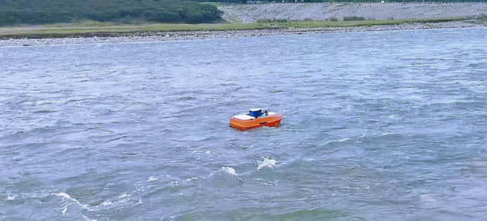 Unmanned Ship Survey
Unmanned ships have great application space in water environment investigation and survey, effectively improving the efficiency of surveying and mapping work and saving manpower and material input. Unmanned ships can be equipped with ADCP, sonar side-scan, multi-beam, depth sounder and other measurement tasks. Our unpowered towed unmanned boats, remote control survey unmanned boats, autonomous navigation unmanned boats, ADCP river crossing, water sample collection, underwater terrain mapping can be applied.
We provide a variety of unmanned ship solutions, unmanned ship applications, support custom development of unmanned ship products.
Unmanned Ship Survey
Unmanned ships have great application space in water environment investigation and survey, effectively improving the efficiency of surveying and mapping work and saving manpower and material input. Unmanned ships can be equipped with ADCP, sonar side-scan, multi-beam, depth sounder and other measurement tasks. Our unpowered towed unmanned boats, remote control survey unmanned boats, autonomous navigation unmanned boats, ADCP river crossing, water sample collection, underwater terrain mapping can be applied.
We provide a variety of unmanned ship solutions, unmanned ship applications, support custom development of unmanned ship products.
-
 Drone Flow Measurement
Intelligent UAVs are used in hydrographic survey. The UAVs automatically perform flow measurement tasks according to the planned flight path, and the measurement data is transmitted online in real time. Video information of river hydrological elements and river potential, including water width, water level, depth and velocity, is collected manually or according to preset test scheme. All information is transmitted wirelessly to the shore computer in real time, and the software draws the "Flow volume test site Analysis Chart", calculates the section flow, and generates the "Velocity measurement record and flow calculation Table".
Drone Flow Measurement
Intelligent UAVs are used in hydrographic survey. The UAVs automatically perform flow measurement tasks according to the planned flight path, and the measurement data is transmitted online in real time. Video information of river hydrological elements and river potential, including water width, water level, depth and velocity, is collected manually or according to preset test scheme. All information is transmitted wirelessly to the shore computer in real time, and the software draws the "Flow volume test site Analysis Chart", calculates the section flow, and generates the "Velocity measurement record and flow calculation Table".
-
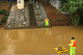 Hydrographic Survey
Hydrographic survey-Velocity discharge is an important data measurement work, we have been engaged in the promotion and application of hydrologic instruments for many years, and have rich experience in ADCP, radar wave current measurement, water level meter and other instruments. It can collect the data of velocity, water level and flow of hydrologic data, send and receive data remotely, and integrate the software processing of data, and also realize real-time online monitoring. He also has rich practical experience in the daily test of hydrological level, velocity, discharge, patrol survey and flood peak test.We provide a full range of technical support, product, software custom development
Hydrographic Survey
Hydrographic survey-Velocity discharge is an important data measurement work, we have been engaged in the promotion and application of hydrologic instruments for many years, and have rich experience in ADCP, radar wave current measurement, water level meter and other instruments. It can collect the data of velocity, water level and flow of hydrologic data, send and receive data remotely, and integrate the software processing of data, and also realize real-time online monitoring. He also has rich practical experience in the daily test of hydrological level, velocity, discharge, patrol survey and flood peak test.We provide a full range of technical support, product, software custom development
-
 Underwater Terrain Mappin
Through side-scan, sonar, multi-beam, GPS satellite positioning system and other visual measurement data and maps combined with software, the underwater topographic survey can be applied to reservoirs, lakes, ports and docks to provide basic data and maps of underwater terrain, etc., dredging of inland rivers, lakes and oceans, navigation survey applications, and search and locate people and vehicles falling into the water in specific areas. Emergency rescue search and rescue.
Underwater Terrain Mappin
Through side-scan, sonar, multi-beam, GPS satellite positioning system and other visual measurement data and maps combined with software, the underwater topographic survey can be applied to reservoirs, lakes, ports and docks to provide basic data and maps of underwater terrain, etc., dredging of inland rivers, lakes and oceans, navigation survey applications, and search and locate people and vehicles falling into the water in specific areas. Emergency rescue search and rescue.
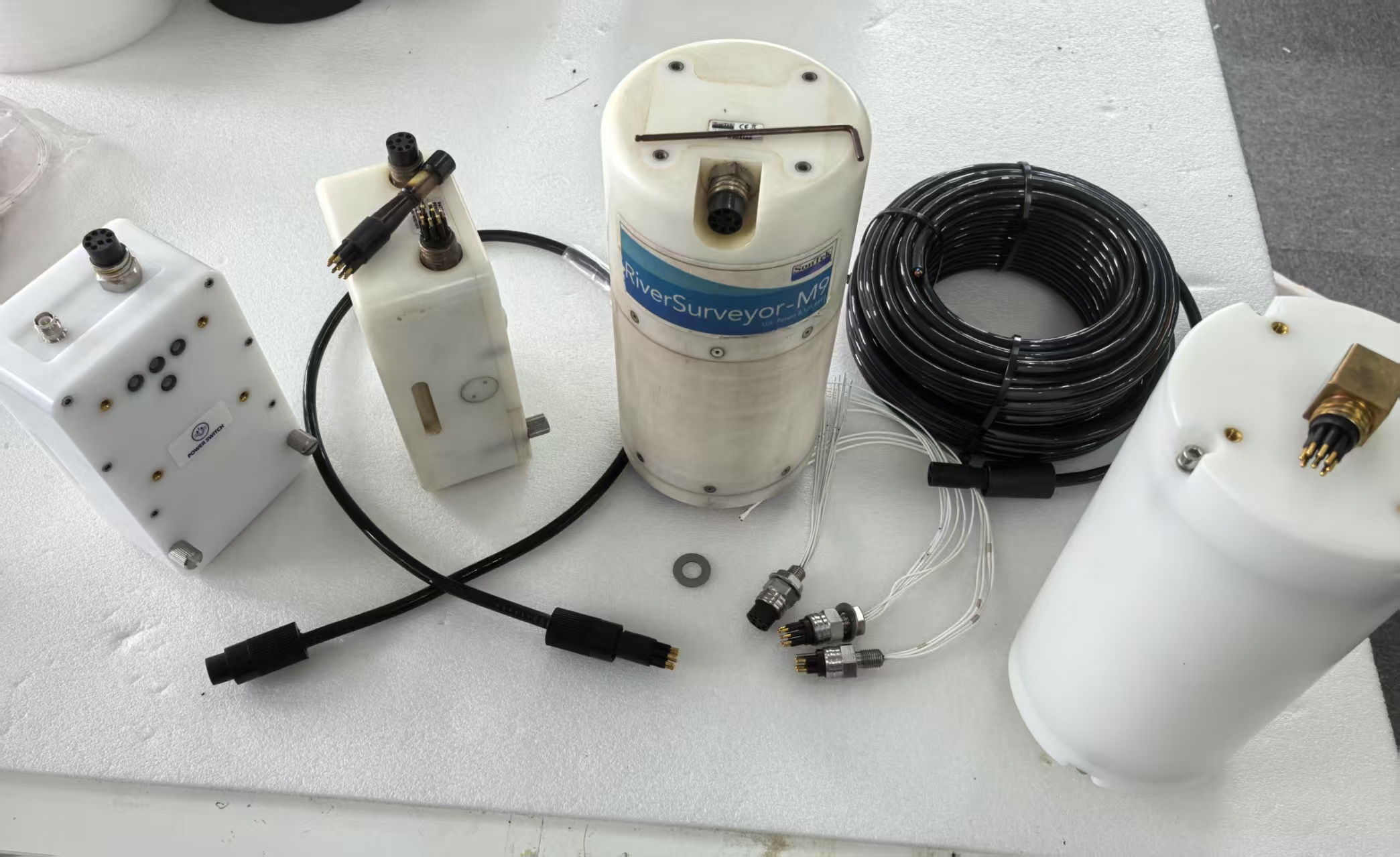 Underwater Wet Plug Connection
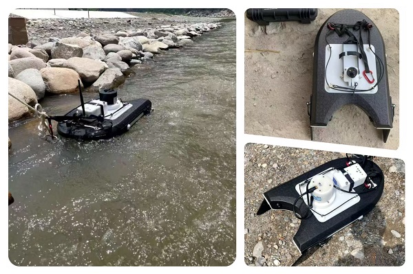 Lightweight portable ADCP BOAT
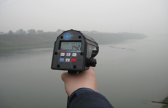 Handheld wave current meter